“If we could start today, that’s where you and I would put it,” Pierson says of the surrounding hills. “You can’t blame somebody for past sins.”
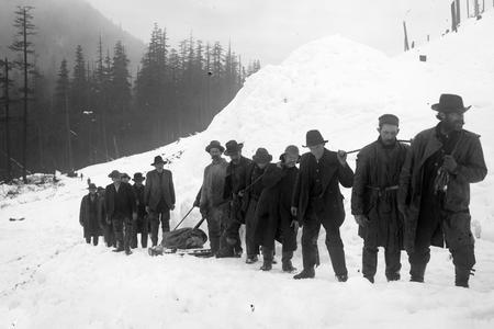
Then, on Dec. 3, 2007, the biggest flood on record inundated the Chehalis River Basin to reignite a century-old debate over how to manage flood risk. Hurricane-strength winds battered the coast, and high in the Willapa Hills, the birthplace of the Chehalis River, more than 22 inches of rain fell onto commercial timberlands in a single day, triggering more than 2,500 landslides. The swollen river rushed down narrow canyons toward the town of Pe Ell, turned east, and filled the flat, broad plain where the towns of Centralia and Chehalis are located like a faucet filling a bathtub.
Grocery stores were filled with 6 feet of water, Interstate 5 closed for four days, and farmers throughout the basin huddled in their homes while listening to the cries of drowning livestock. One rancher lost an entire flock of sheep save one, which was presumed to have survived by standing on top of the carcasses.
More than a hundred Lewis County homes were demolished or destroyed as a result, and total losses were calculated to be more than half a billion dollars. Then-governor Christine Gregoire personally volunteered in the recovery effort, dishing out food to displaced locals, following a tradition of political leaders visiting flooded Southwest Washington and vowing to put an end to the damage. (After the floods of 1996, President Bill Clinton visited Woodland High School, an hour south of Chehalis, and pledged federal aid to the cleanup effort.)
But the 2007 flood could foreshadow what’s to come as climate change brings rising waters to seaside and river basin communities around the world. Climate scientists expect intense winter storms to become more frequent in Western Washington by the end of the century, putting even more homes along the Chehalis River at risk of flooding. Local leaders, having inherited towns that developed long before modern floodplain policy existed, must now decide how to face the growing risks of living there.
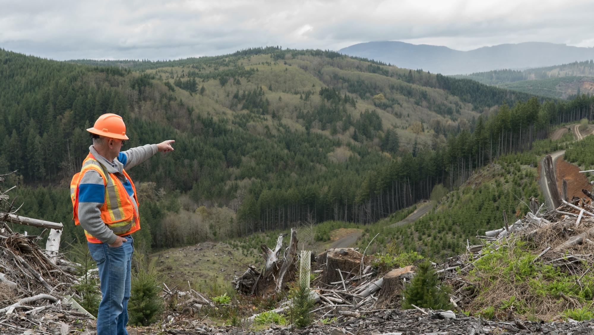
Every way to reduce flood damage comes down to two options: move the water or move out of the way. Ideas for controlling flooding on the Chehalis River have been bandied about for 90 years, from levees to floodwalls to habitat restoration. But a proposal that some backers hope will become reality by 2030 courts controversy: A dam at the headwaters of the river.
The dam would be 270 feet high and span across a deep canyon surrounded by commercial timberland. A quarter of the valuable buildings currently at-risk are expected to remain safe during the next 100-year flood if the dam were built, and peak floodwaters would drop by an estimated 1.8 feet in Chehalis and about 1.6 feet in Centralia.
But only recently has this big idea undergone a thorough environmental study by the Washington state Department of Ecology, and the results are in: The dam would reduce flooding in several hard-hit downstream cities. But that would come at the expense of amphibians, recreation access and, perhaps most critically, the salmon downstream tribes and fishermen rely on. It could even risk the water supply and lives of those who live in the small town of Pe Ell, one mile away from the proposed flood mitigation project.
The future of the Chehalis River Basin, the second-largest watershed in Washington state, hangs on decisions made by the Office of Chehalis Basin and its board members, who represent the Quinault Indian Nation, the Chehalis Tribe and the basin’s cities and counties. The office was created by the state Legislature in 2016 as part of the Department of Ecology and tasked with the twin goals of reducing flooding and restoring aquatic species such as salmon. These have been formally yoked together by state law and have created an unusual alliance between groups whose priorities can at times stand in direct opposition.
Over the past few weeks, as the potential impacts of a dam have become clear, lines have been drawn between members of a group bound by state law to work together. The Chehalis Tribe has opposed construction of a dam on the river for years, and the Quinault Indian Nation declared its opposition to the project in April. But the Chehalis River Basin Flood Authority — which represents the three Washington counties and 10 cities most affected by flooding along the river — subsequently endorsed the dam.
The dam would primarily benefit the Centralia and Chehalis areas, which are the largest population centers in the central part of the basin and the towns that suffered the most extensive damage in the 2007 flood. It would slightly reduce flooding downstream on the Chehalis Reservation and do little for cities in Grays Harbor County, where the river empties into the harbor and then to the sea.
For the Indigenous Chehalis people who have lived alongside the river since before recorded history, flooding is understood as a regular part of the seasonal cycle. Historical records recognize this pattern, too, and accounts from early white settlers recall winter floods for miles in every direction in the area now incorporated as the cities of Centralia and Chehalis.
“Having lived with the river for countless generations, tribal people have always undertood that building in the floodplain is not a good idea,” says Jeff Warnke, director of government and public relations with the Confederated Tribes of the Chehalis Reservation.
Initially, white settlers also built their houses on the hills. But when the railroad arrived in 1872, the logging industry took off. As wood was cleared from the banks of the river, the channel deepened, and winter floods that once covered the entire valley with a few feet of water were contained inside an ever-deeper channel. Some seasonal flooding continued, and it was considered enough of a nuisance that in 1931 the Army Corps of Engineers conducted the first of what has since added up to more than 800 studies conducted by groups throughout the basin to determine the feasibility of controlling the floodwaters. The Army Corps decided then that flood control didn’t make economic sense.
But the floods are getting worse, and the economic calculus has changed. The 2007 flood was the worst in the history of the basin, and increasingly expensive structures have been placed in the way of the water over the past several decades. With climate change turning 100-year floods in the basin into a twice-a-decade event, the stakes are rising with the waters.
Flood, fight, forget
“If it was an easy problem to solve, it would’ve been solved back in 1933,” says Lewis County Commissioner Edna Fund, a member of the Chehalis Basin Board.
After deciding in the 1930s that flood control didn’t make sense for the Chehalis, the Army Corps would return to consider and reject big dams in the ’60s, levees in the ’70s and enlarging the preexisting Skookumchuck dam in the ’80s.
Finally, the Army Corps proposed building 11 miles of levees around the two cities. That idea got congressional authorization before being abandoned because the levees would have exacerbated flooding outside their walls and failed to protect the interstate highway. The section of I-5 between Centralia and Chehalis, first completed in 1954, has since been inundated and closed during every major flood in the area. The Washington State Department of Transportation has considered moving it, raising it, building a viaduct, express lanes or walls. All were rejected because of cost.
“If you take a look at Centralia and Chehalis, to move them out and to move I-5, the dollar amount is way beyond what any of us could fathom,” Fund says. “We probably have 24,000 people. Moving them and moving a U.S. freeway — that’s just unfathomable.”
But relocating an entire community because of climate change isn’t unheard of, even within the Office of Chehalis Basin. The Quinault Nation is currently moving its main village, Taholah, because of a rising sea level. Moving Taholah, population 810 in 2010, is estimated to cost more than $50 million.
Before the Quinault Nation got involved with the Chehalis Basin process, there was no real consideration to the idea of restoring the floodplain’s natural function as a way to protect people and buildings. The Quinault Nation, which has treaty rights to fish in the Chehalis Basin, brought in Seattle-based engineering firm Natural Systems Design to evaluate the viability of moving people out of harm’s way and adding back natural elements like in-stream wood, wetlands and forests.
After studying how the Centralia and Chehalis area flooded throughout history, Tim Abbe, chief science officer of Natural Systems Design, says “the story really started to come together. That was an area that did store lots of water and flooded regularly, and unfortunately people decided to concentrate development there.”
Much of that development, though, occurred before modern floodplain policy was put in place. In the 1996 flood, the vast majority of damage was to buildings constructed before floodplains in Centralia were even identified.
Abbe and Natural Systems Design found that bringing more natural vegetation back to the river wouldn’t by itself achieve the drop in water levels that the cities were looking for, although he remains optimistic that a restorative approach could be part of the larger plan. Also, moving people to open up enough land to reconnect the floodplain required asking locals to voluntarily relocate, buying out properties or using the government’s power of eminent domain to evict them.
“The only certain and permanent way to protect people from flood damage is to get them out of harm’s way,” says Abbe.
A recent report to the Federal Emergency Management Agency found that buying out houses in flood-prone areas could save the government billions over the long haul. And the Trump administration recently shifted its message to cities dealing with repeated flooding, telling local officials to evict people who won’t move out of flood-prone areas in return for federal money for combating climate change.
Even so, the use of eminent domain is usually political suicide. “You won’t survive in office,” if you try it, says Pierson.
Dam in detail
The conversations now echo what happened 10 years ago, when 25 people gathered inside a refurbished barn in Rochester, Thurston County, for a public meeting held by the Chehalis River Basin Flood Authority.
At the time, two dams were proposed by One Voice, a citizens group that formed after the 2007 floods and represented small business owners and locals from Lewis, Grays Harbor and Thurston counties. The two dams were proposed for the headwaters of the Chehalis River, one south of the town of Boistfort and the other south of Pe Ell. The Boistfort-area dam died, but the idea to put a dam one mile upstream of Pe Ell lives on as the current project site.
Many of the details have been filled in. When particularly intense storms come through, the dam's gates would be shut, trapping water and temporarily submerging 847 acres of trees and plants behind it in a temporary reservoir. The water would be released over a period of about a month. When the gates are open, fish would be able to swim through freely, but during big storms they’d be trucked around the reservoir to be released upstream.
This kind of dam costs less than one that creates a permanent reservoir, and on its face seems like a better deal for salmon, which would be able to experience the river as usual most of the time. But other work on aquatic species restoration done by the Office of Chehalis Basin found that high water temperatures are the highest-priority issue for fish in the area. And because few native plants are expected to survive being submerged under stormwater for a month, shade trees would all but vanish from behind the dam, leading to an increase in water temperatures of up to 9 degrees Fahrenheit.
Spring chinook are especially affected by this problem, and the area above the dam is one of three known places in the entire basin where they spawn. Even so, proponents argue that with fewer than 10 spring chinook spawning in the area each year, and with climate change set to harm them anyway, it doesn’t make sense to stop a project that could benefit thousands of people to save a handful of doomed fish.
“I hear that comment, too: ‘We found that a very small percentage of all spring chinook spawn above the dam site, so why are you making all this noise about spring chinook?’ ” says Mara Zimmerman, a former lead scientist with the Washington Department of Fish and Wildlife, who oversaw data collection for salmon near the proposed dam.
“The river and tributaries above Pe Ell [are] an important area to bring spring chinook back, not to degrade it further,” Zimmerman says.
The state’s environmental review found unavoidable impacts beyond harming fish. The dam would also make 14 miles of river permanently inaccessible to kayakers and 13 miles of shoreline permanently lost to fishermen, while risking the lives of everyone in Pe Ell, should an earthquake occur while the dam is holding water. A mitigation plan that would lay out how the dam’s backers hope to correct for these concerns has yet to be released.
Tribes risk inundation as well. Seventy-five percent of the reservation that that the U.S. government forced the Chehalis people to relocate to in the 1850s is in the floodplain. It was covered with water during the 1996 flood, and one tribal member died during that storm because of an inability to access health care.
But even though they’re also directly affected by the rising waters, the Chehalis Tribe has formally opposed building a dam on the river since at least 2009. That's when its tribal flood plan prioritized respect for the river and a wish to preserve its natural character over mechanical methods of reducing flooding. Instead, the tribe’s plan focuses on “accommodating river movement, flooding and erosion, rather than confining the river or changing its flows.”
Representatives from Lewis County and the cities of Centralia and Chehalis who have long backed a dam are still hopeful that the project goes forward.
“What has driven my optimism for eight years now — and it remains in place — is if we get back at looking at all these things together, including a mitigation plan, all of the communities in the basin will see a net positive,” says J. Vander Stoep, a Lewis County attorney and member of the Chehalis Basin Board.
The world to come
On April 21, in the midst of statewide shutdowns during the coronavirus pandemic, more than a hundred people logged on to a glitchy web platform to weigh in on the future of the dam. Only one, the last commenter of the night, expressed support.
The Quinault Nation released its recommendation for a Plan B on May 12. The plan would involve a closer look at alternatives like buying out properties in the floodplain.
“This is a problem that’s not going away. Our climate is changing rapidly; we can only engineer ourselves out of these situations for so long before we have to go back to the drawing board and do it all over again,” says Tyson Johnston, vice president of the Quinault Indian Nation.
The board members must decide by the end of 2020 on a recommendation to the Legislature for next year’s session, and with climate change and budget deficits looming, the consequences of taking no action will still harm both people and fish.
“We’re sort of on borrowed time before the next big flood hits. We know that climate change is going to make both of these problems worse,” says Andrea McNamara Doyle, director of the Office of Chehalis Basin.
While the future of a dam is still unclear, communities in the basin have begun taking local action to help reduce flood damage in smaller-scale ways: improving the warning system, elevating houses and building “farm pads” — raised mounds of dirt where livestock can be shepherded to stay above water during a storm.
French Wetmore, president of French & Associates, a floodplain management consulting group that’s been working with Chehalis Basin communities for years, says that even though the basin has one of the worst flooding problems in the state, it’s nowhere near as bad as other parts of the country because Washington state has done a comparatively good job of limiting building in floodplains. But the National Marine Fisheries Service found in 2008 that while following the most stringent federal flood regulations could save people, it would do little to keep endangered fish safe in the Puget Sound area.
“The Quinault Nation is probably one step ahead of the rest of us, and there’s no really good system to balance the two, of protecting people and protecting fish,” says Wetmore.
“You can protect people at the expense of protecting fish, and vice versa.”