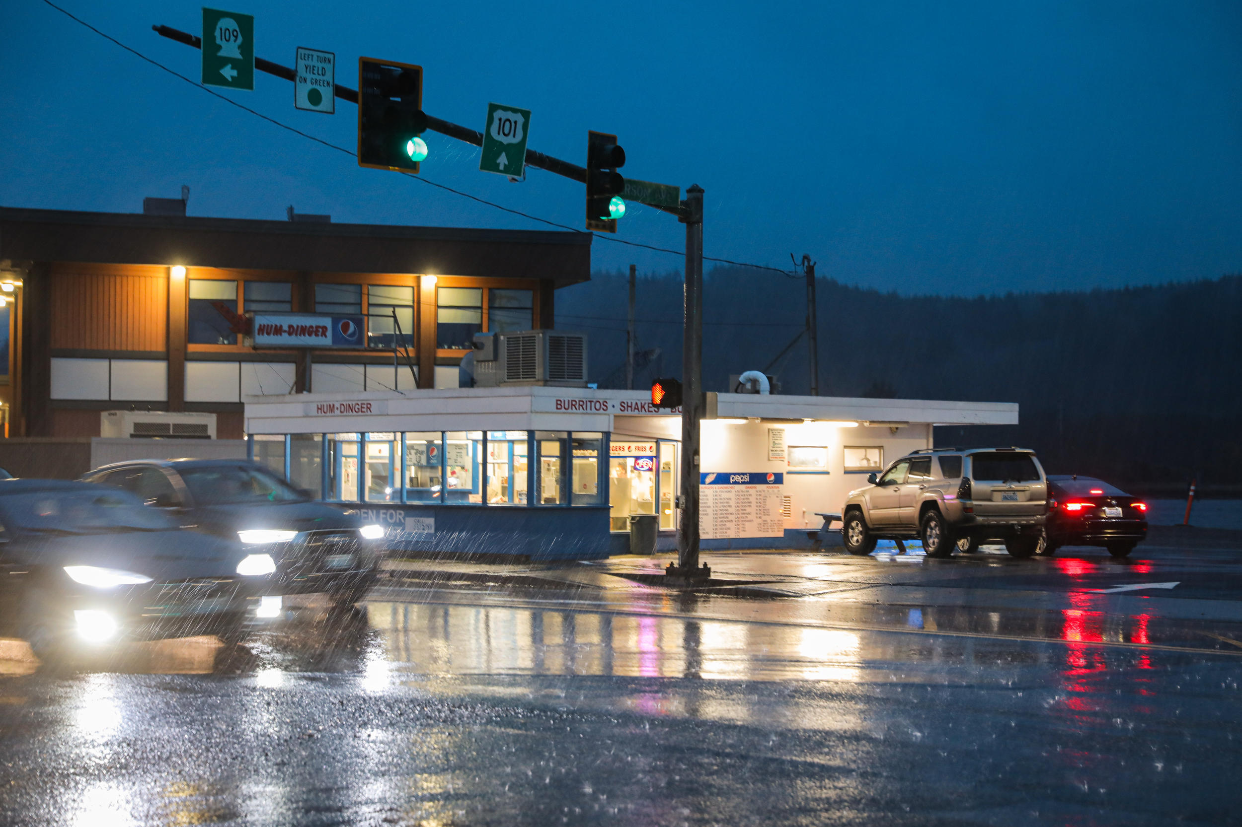
Al’s Humdinger has been a Hoquiam landmark since the 1950s. The burger joint flooded in January 2022 when the Hoquiam River, just behind the building, overflowed its banks. (Genna Martin/Crosscut)
Alone and laser-focused on scouring the inside of an oven hood, she heard a knock on the door: A bank employee stopped by to let her know the river was overflowing.
Schmid panicked, waded to her truck through foot-high water and went to collect materials to make sandbags. She returned with four bags and every towel she could find. It wasn’t until a police officer stopped by to tell her she’d likely get electrocuted if she didn’t leave that she finally relented. The officer threw the breaker on the electrical panel, and they both jumped out the front window.
“It was pretty horrific to me, and unexpected. That’s for sure,” Schmid recently recalled. “The garbage cans were floating everywhere. It was just bizarre.”
When she returned not long after, Schmid said a prayer, turned on the electrical panel, and breathed a sigh of relief. “But it was just a sloppy, terrible, muddy mess,” she said.

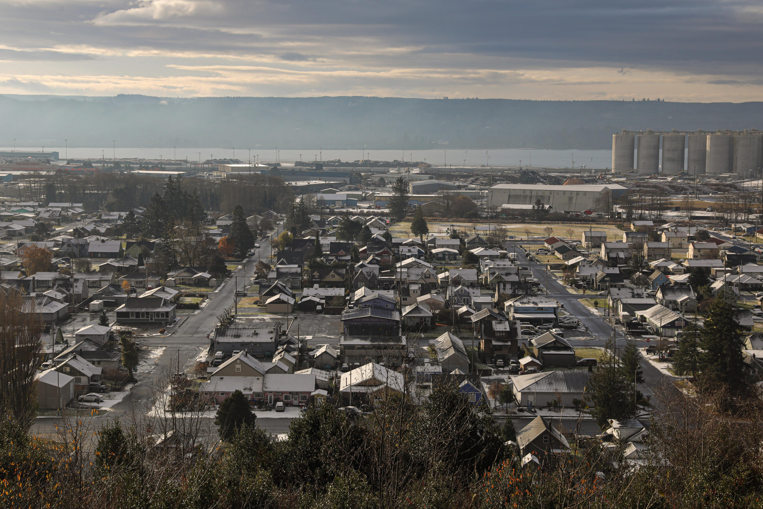
Severe flooding exacerbated by climate change has become less and less of an anomaly in coastal Grays Harbor County. The twin cities of Aberdeen (pop. 17,191) and Hoquiam (pop. 8,860) sit adjacent to each other in a crevice of the Olympic Peninsula. They’ve flooded at least once a year for the past five years, pelted by waves, extreme rain and overflowing rivers. Since 1964, records show 17 floods caused so much damage they qualified as federal disasters.
The existential threat of flooding has already reshaped building codes and spiked insurance rates that make it hard for residents to renovate homes or attract business to the area, they say. A Climate Central analysis estimated that flooding will threaten at least $500 million in home value in Aberdeen and Hoquiam by 2050.
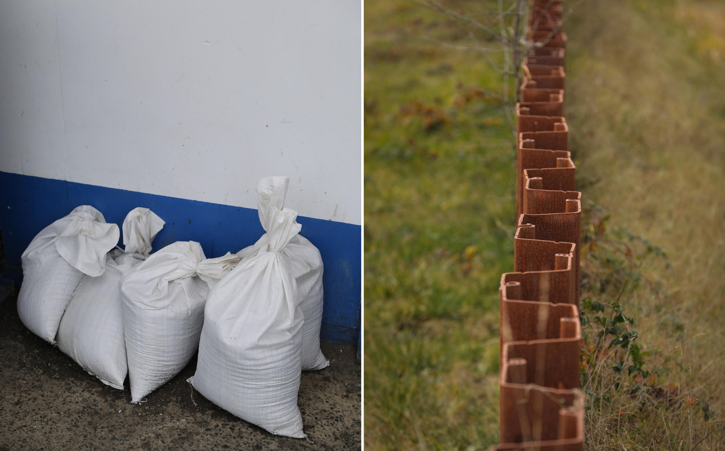
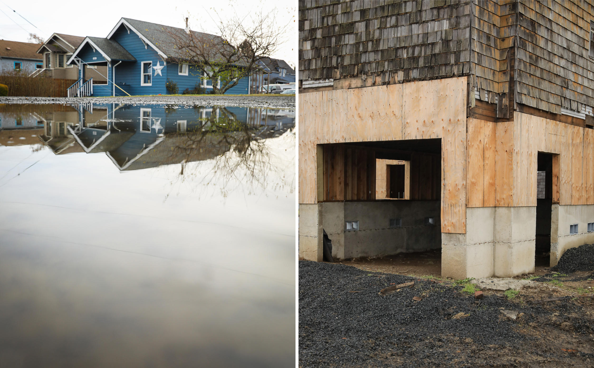
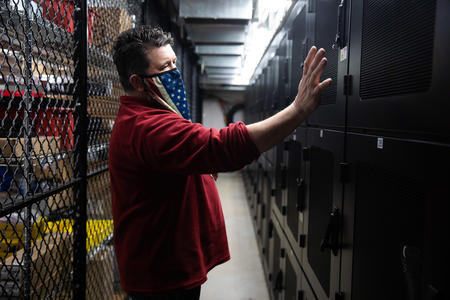
Left: Sandbags outside Al’s Humdinger are on hand in case of flash flooding. Right: A sheet pile levee wall separates wetland from a residential neighborhood in Aberdeen. (Genna Martin/Crosscut)
The twin cities aren’t unique in their vulnerability: At least 35,000 Washingtonians are already at risk of coastal flooding, and 19,000 more are expected to be by 2050 as sea levels rise. But for nearly a decade, they’ve turned heads among scientists and officials working in the hazard-mitigation space for their passionate and single-focused pursuit of a $182.6-million solution that aims to not only keep future waves at bay, but also, they hope, reduce the cost of living and doing business near the coast — enough so that communities will have a shot at economically rebounding in the near term.
The Aberdeen-Hoquiam Flood Protection Project, consisting of two levees and a pump station, has long represented an aspirational moonshot, but an influx of federal funding this year has seemingly pushed the idea into reach with local leaders hosting a celebratory ground-breaking last summer.
“We really need to act now,” Hoquiam City Administrator Brian Shay said. “It’s a once-in-a-generation project of the greatest magnitude. … Our existing system and infrastructure just cannot handle it.”
This is the first story in a three-part series on infrastructure in Grays Harbor County from Crosscut’s WA Recovery Watch, an investigative project tracking federal dollars in Washington state.
Whether it’s the right solution remains to be seen. Levees have gotten bad raps since their failure in New Orleans during Hurricane Katrina, and their construction often involves building up coastlines already losing habitat. The nearby Quinault Indian Reservation town of Taholah has instead opted to rebuild itself at a higher elevation with new federal assistance. Other coastal towns are investing in tsunami towers that protect people but not property.
Interviews with more than two dozen local officials, federal disaster experts and Grays Harbor residents reveal deep concerns about the costs of coastal flooding, as well as questions about new problems mitigation efforts might create.

Grays Harbor towns receive an average of 95 inches of rain per year. (Genna Martin/Crosscut)
But with billions in federal funding newly available for climate resilience, Hoquiam and Aberdeen’s investments may serve as roadmaps for other coastal communities reflecting on their own vulnerability and values.
“More states and local jurisdictions are realizing we aren’t going to ‘respond’ our way out of increasingly frequent climate-related disasters, and more needs to be done to reduce disaster risk beforehand,” said Kevin Zerbe, natural hazards mitigation strategist with the Washington Emergency Management Division. “I think when you zoom out a little and take a look at everything that’s going on, there’s a lot to be optimistic about.”
Hoquiam is surrounded on three sides by water. In 2015, floodwaters from the Chehalis River made their way all the way down North Maple Street, left, and Willow Street, right. (Genna Martin/Crosscut)
'If sea levels rise, I’m doomed'
When settlers started building up Grays Harbor County in the 19th century, they looked at water as a challenge. In an act of hubris or ingenuity, depending on whom you ask, settlers lifted the earth to meet us. They speckled coastal tideflats with infill, which regulations prevent today, and stood homes and cities upon loose soil.
The new arrivals fished, hunted and, above all, logged. When the timber industry declined with the Great Depression, and again with old-growth legislation, mills closed and jobs disappeared — but the people remained. Grays Harbor has since faced some of the highest rates of unemployment and poverty in the state, with 14.5% of the population currently below poverty level.
Floods have only made it harder to turn things around.
Hoquiam’s Shay grew up in South Aberdeen, and remembers rowing a boat with his dad in the street. As an adult, he wound up on KING5 TV when two feet of water spilled into his home’s basement. But flooding makes life difficult for people even before it happens, he learned, when local librarian Mary Thornton approached him about flood insurance a few years back.
When Thornton bought her home near the stadium in Hoquiam, insurance hadn’t been part of the conversation. But she soon learned she was legally obligated to buy it.
The Federal Emergency Management Agency began rating areas for flood risk and offering flood insurance through the National Flood Insurance Program half a century ago. FEMA rated most of Hoquiam and Aberdeen as a special flood hazard area, or a place where its floodplain management rules, building codes and insurance requirements are enforced. Many buildings within this zone are rated as generally having a 1% chance of flooding annually, Bird said, and FEMA suggests they have a 26% chance of flooding over the course of a standard 30-year loan. Anyone with a federally backed mortgage in areas like this is required to carry flood insurance.
The premiums started out affordably for Thornton, a few hundred dollars a year. But then the federal government stopped subsidizing insurance. In 2015, she went to Shay.
“I said, ‘I can afford to pay for my house, but it’s the flood insurance that’s killing me,’” she said. “And it kept going up.” Her last annual bill with FEMA came to about $11,000, she said. Per capita income in Grays Harbor is $28,259.
She switched to newly available private flood insurance four years ago, and her premium fell to about $500. “Now when I hear people say, ‘Oh, we're looking to buy a house,’ I say, ‘Look to see if you need flood insurance,’” she said.
“If sea levels rise, I’m doomed. But I mean, I probably won’t be here then,” Thornton added.
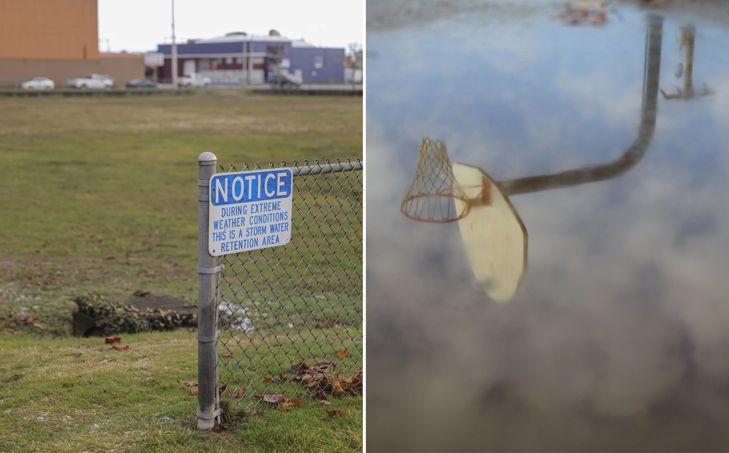
Franklin Field in Aberdeen, home to a baseball field and baskeball court, is used as a stormwater retention area during periods of high precipitation. (Genna Martin/Crosscut)
About a fifth of county households are low-income renters. After floods, many renters and some residents who’ve paid off their homes and elected to drop insurance lose belongings and get displaced.
Flooding can still be traumatic even when insurance kicks in.
“Every time it rains and I hear ‘king tides,’ I just panic,” said Candie Gleason of Aberdeen. She has carried flood insurance for peace of mind since her home flooded for the first time in 2015. Six inches of water infiltrated the base level of their home, doing $25,000 in damage.
“To this day … nothing is sitting on the floor, ever. It’s all up at least two feet,” said Gleason, who had to throw a lot away. “I've lived here all my life. I've never seen water like we did that year. And then we got it again last year.”
FEMA has paid out at least $5.1 million in claims to people in the area since 1979, Shay said, with $4 million paid out in 2015 alone. Meanwhile, in 2016, the cities learned from public records requests that people had been paying about $2.2 million annually in NFIP premiums in 2014; despite increased interest in private insurance, total federal premiums still hovered around $1.78 million in 2018. “We're paying out way more on insurance than people are ever actually getting back,” Shay said.
Even with cheaper private insurance, there are concerns about guaranteed access to it. And the building-code hurdles remain. Shay said cumbersome codes often deter homeowners and economic development in the area.
If someone wants to renovate a home and the work costs more than half its value, they’re required to raise the house above the current floodplain. That can mean adding a whole new foundation, which can ultimately cost more than the original project. Unable or unwilling to pay, homeowners rent homes out, let them deteriorate uninhabited or raze them entirely, removing increasingly scarce housing, which has a real impact on the local economy’s recovery efforts.
“No employer wants to site their location if they can’t attract the workforce,” said Lynnette Buffington, CEO of Greater Grays Harbor.
About 13,660 people are employed in the twin cities, which report losing 842 jobs over four years.
At least one affordable-housing project ultimately fell apart due to code requirements, Shay said. The institute couldn’t finalize federal funding.
“We don’t need flood insurance because we don't have a mortgage, but if we ever sell the house, people might not want to buy it,” noted Thornton’s friend Glenda Seymour.
“Unless there’s that levee.”
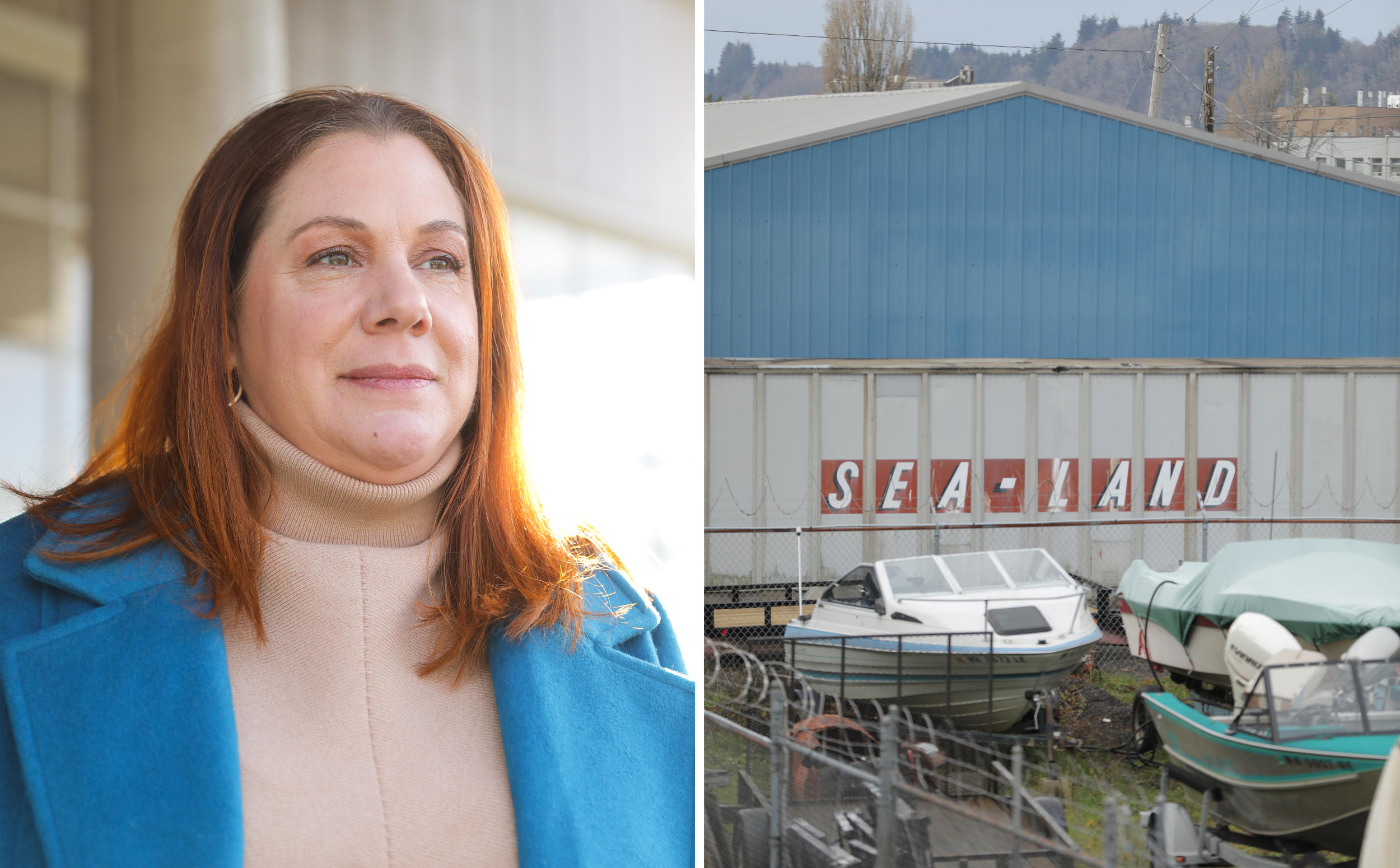
Left: The CEO of Greater Grays Harbor, Lynnette Buffington. Right: Evidence of the community’s strong connection to the water is found in all corners of Grays Harbor. (Genna Martin/Crosscut)
A plan takes shape
Aberdeen had been exploring a small eastside levee at the mouth of the Wishkah when, in January 2015, nearly 11 inches of rain pelted the coast over a 24-hour period. Aberdeen’s leaders approached Hoquiam about completing a larger levee together.
“We finally hit that breaking point where we said, enough is enough,” Aberdeen City Engineer Nick Bird said.
Collaborating with U.S. Rep. Derek Kilmer, D-6th District, the cities coordinated a coastal resiliency strategy that suggested building not one but two levees spec’d for 80-year climate projections, and a pump station to handle stormwater and river flows.
The levees would protect 5,100 properties and 1,354 businesses, which the cities say will maintain 1,292 jobs and help create others. If FEMA certifies their ability to hold back a 100-year flood, FEMA would adjust the flood-risk ratings for properties behind the levees, removing insurance and building code requirements. The cities are designing the levees for a 500-year flood as required by federal regulations associated with grant funding.
“Some of these people would be wise to continue some flood insurance because a levee doesn't protect against all sources of flooding,” said FEMA’s Scott Van Hoff, a regional flood-insurance liaison. “But there's no question that the levees are going to significantly reduce the impact of one significant source of flooding.”
Officials hope the levees, paired with the pump station, can significantly reduce the likelihood of catastrophic flooding when tides and rain converge and remove the financial stress of mandatory flood insurance.
“Every town hall meeting we do in Aberdeen and Hoquiam, this is the topic,” said Kilmer, adding that people are insistently enthusiastic.
Nearly 30 years ago, the U.S. Army Corps of Engineers designed and built a certified levee in South Aberdeen to protect it and Cosmopolis. Shay said the area has seen tremendous new development since.
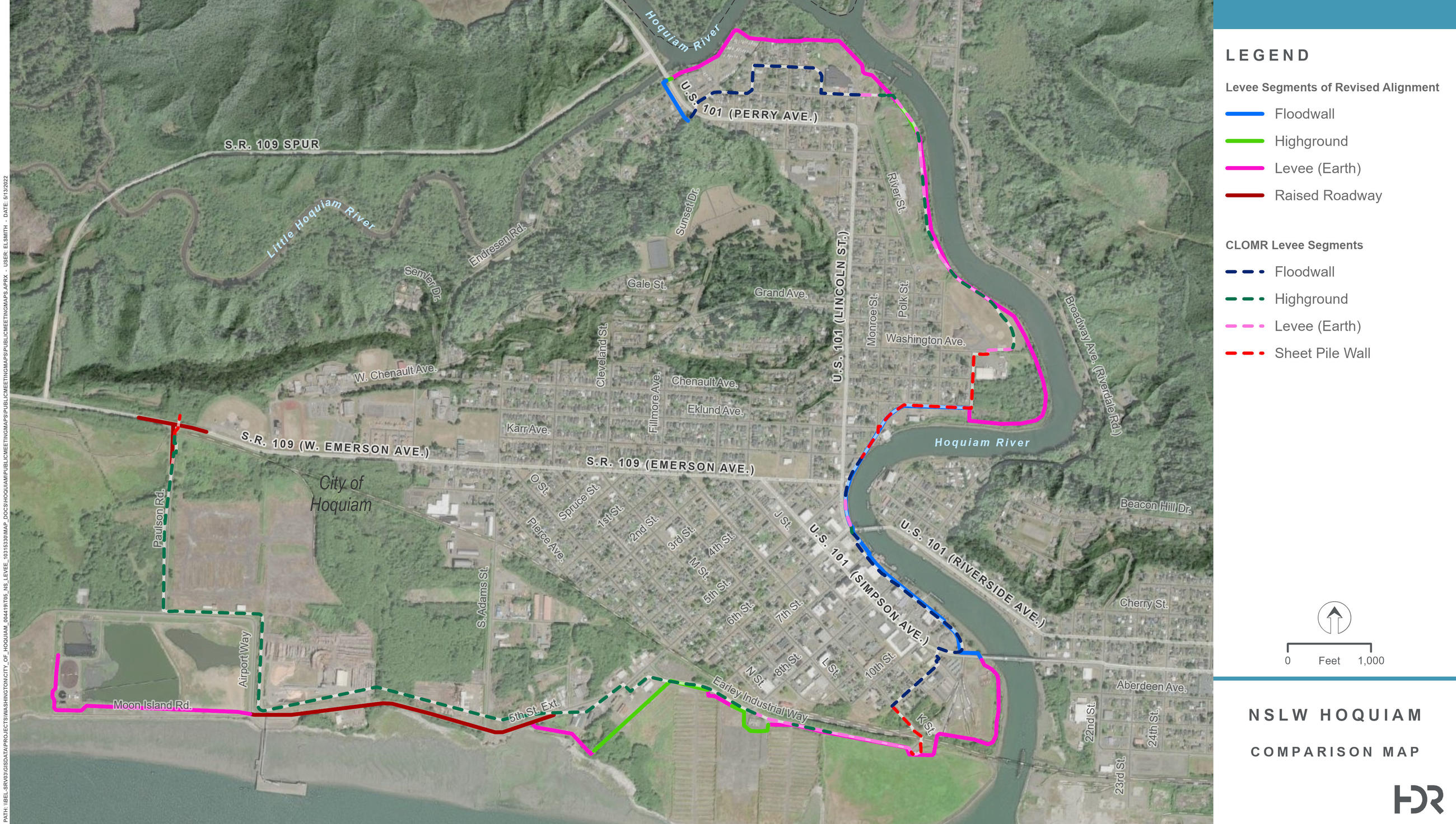
This map shows the proposed location of the North Shore Levee-West segment along the west Hoquiam waterfront. The final route of the levee is still under design. (Courtesy of HDR)
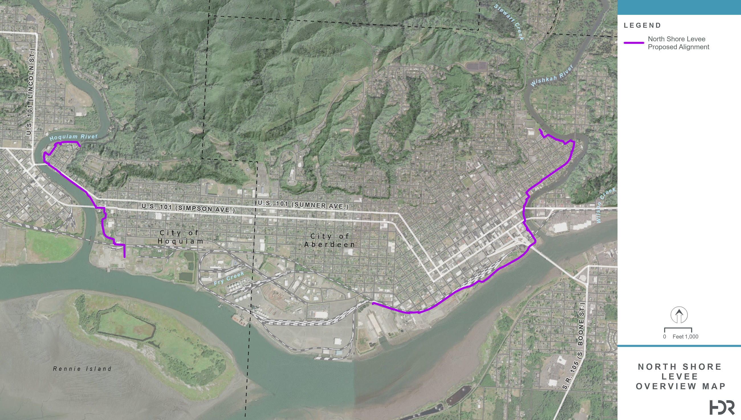
This map shows the proposed location of the North Shore Levee segment along the Aberdeen and east Hoquiam waterfront. The final route of the levee is still under design. (Courtesy of HDR)
Recent designs show the new levees would snake around the cities’ shorelines, made of a patchwork of sheet pile, earthen berms and concrete walls up to five feet high interspersed with flood gates. The easternmost point of the North Shore Levee would start a mile upstream from the mouth of the Wishkah, hug the shoreline until it reaches Grays Harbor, and route a dozen or so blocks before it juts out above the Port, protecting the downtown core. Cutting through east Hoquiam along an old railroad track, it would continue around a group of vacant lots before taking a right turn at the Hoquiam, cutting a backwards question mark along the channel before ending where 16th Street turns into Broadway Avenue.
The North Shore Levee West segment picks up on the other side of the Hoquiam, curling along the East Fork — past Al’s Humdinger — down to the mouth, again following railroad tracks before pulling back just above the Hoquiam Sewage Treatment Plant.
A new Fry Creek Pump Station and restoration project, already under construction across the street from the Port, will help drain waters and create a fish passage.
Aberdeen’s Bird said slight adjustments are being made to the design, which those involved hope to finalize in the first half of this year.
“The one fear that I always had was, how were we going to pay for it?” Shay said. But the cities rallied a coalition of local, state and federal support. And this year, FEMA’s Building Resilient Infrastructure Communities fund showered $50 million on the program, with another $35 million in consideration.
“These two projects are a testament to the communities’ leadership, holistically thinking about the problems that are existent, and proactively thinking about mitigation for these perils,” said Jackie Pritchett Jr., chief of FEMA Region 10’s Community Resilience and Infrastructure Grants Branch, who oversees the regional BRIC program.
The project also secured at least $54.8 million combined from the state legislature, city funds and additional FEMA funding.
The cities will eventually invest a total of $15 million into the project.
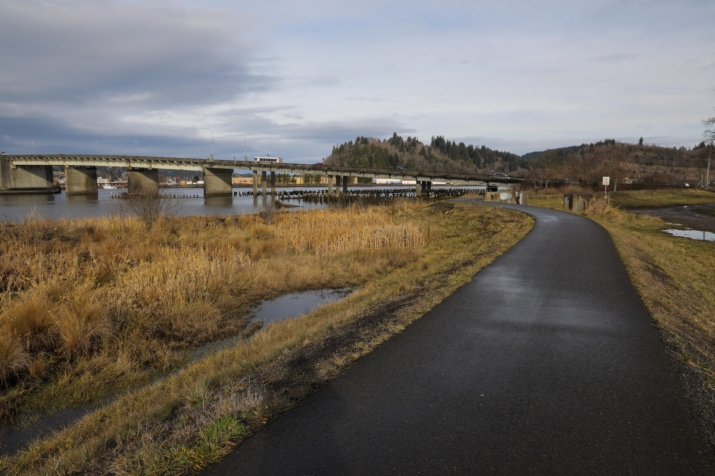
An earthen berm levee with a walk across the top runs along the wetland riverfront in Aberdeen. Similar levees will be built in Hoquiam as part of the Aberdeen-Hoquiam Flood Protection Project. (Genna Martin/Crosscut)
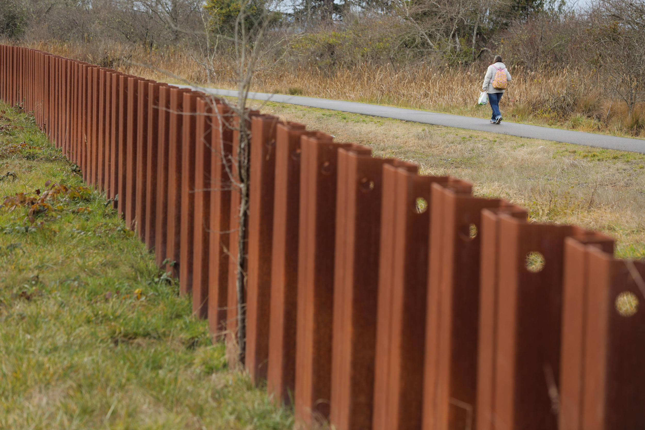
A person walks down a pathway atop an earthen berm next to a sheet pile wall, both built to protect Aberdeen from the flooding Chehalis River. The South Aberdeen Levee project was completed in 1996. (Genna Martin/Crosscut)
Officials ceremonially broke ground on the project on July 8 at the future site of the Fry Creek Pump Station, with Gov. Jay Inslee in attendance. In total, Shay said the Aberdeen-Hoquiam Flood Protection Project has secured about $147 million. The twin cities, through the Office of Chehalis Basin, are requesting $35.5 million for the project in the next biennium.
“I often feel like we're overlooked,” Shay said. “So I've been really pleased with the great support that we've had.”
But if the levees aren’t built exactly to spec, they might not get the certification necessary to remove the areas behind them from the floodplain.
“FEMA is quite strict, and the [U.S. Army] Corps is quite strict on certifying levees,” said a former hazard mitigation planner with Washington State Emergency Management who requested anonymity. “From a FEMA perspective, an uncertified levee is the same as no levee.”
There may be precedent for this in Washington. The ex-state mitigation professional said they heard Wilson Creek in Grant County built a levee to protect its community, which sits in a floodplain, but FEMA ultimately didn’t certify the levee because it was too short.
“To this day, they’ve got this slightly deficient levee that mostly protects them, but … their flood insurance rates are so high because they’re in the floodway, that it’s really difficult for the town to be able to grow,” the former mitigation professional said.
Wilson Creek Town Clerk Kaci Anderson confirmed to Crosscut that the town has an uncertified levee.
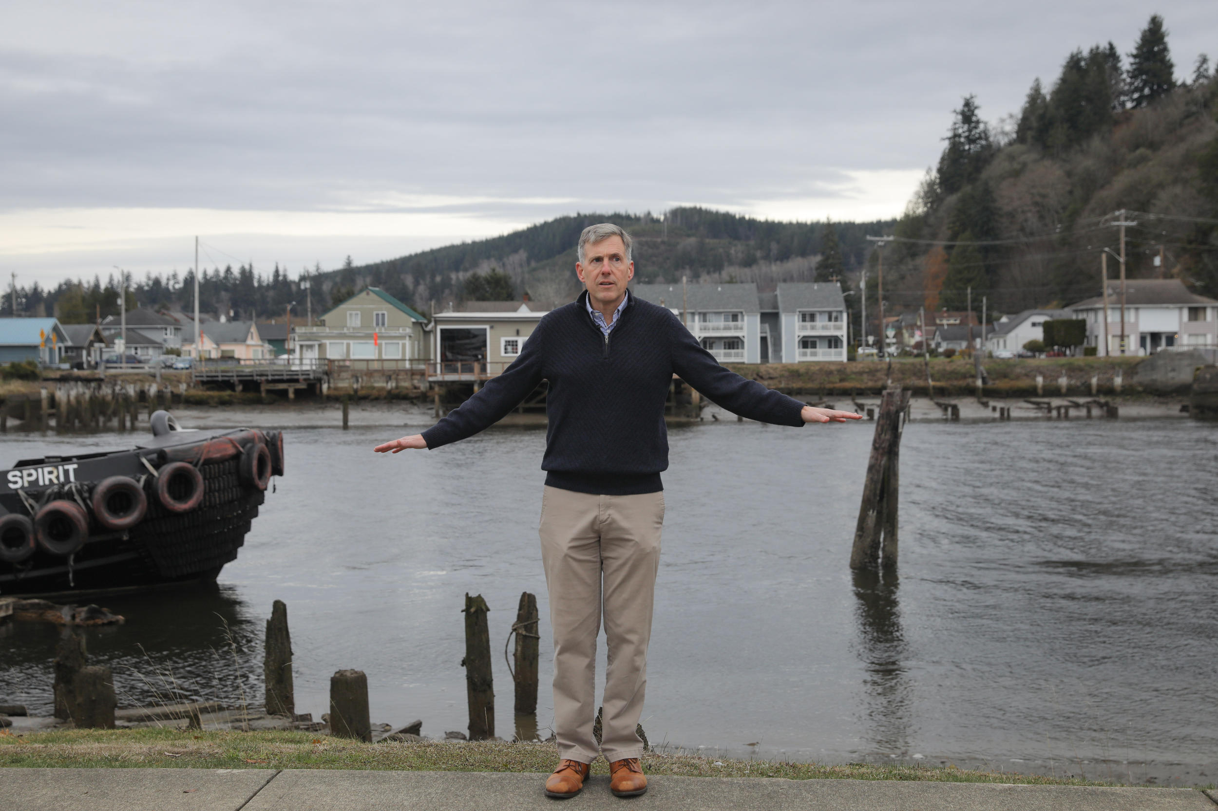
Hoquiam City Administrator Brian Shay shows the height and location of a levee wall to be built along the Hoquiam riverfront to prevent flooding. (Genna Martin/Crosscut)
Building tension
Environmental permitting and review remains the real gauntlet before the project gets off the ground. More than two dozen permits stand between Grays Harbor and levee construction.
Officials expect that process to take close to two years. “We easily could be complete with design and just waiting for permits,” Shay said. Consulting firm HDR took over the final design and permitting for all three components of the project individually over the past two years, and the Beckett Group is helping with federal grants and community outreach. They’re hoping to start construction in 2024, with the levees certified in 2026.
Many permits have to do with ecological protection.
“We have to find the sweet spot to build this levee to provide the protection that FEMA is going to require, while avoiding and minimizing as much as we can impacts to wetlands, to the river, to the harbor,” said the project’s environmental lead consultant, Lisa Danielski, a biological and ecological sciences lead in Washington for HDR.
Construction will be noisy, and might cloud water as it kicks up silt. In separating the cities from water, a previous biological assessment notes the levees risk making it harder for animals like river otters to get around, while interrupting the flow of nutrients. Danielski said otters’ mobility will be minimally affected, while frogs, reptiles and other small to medium-size mammals may have more difficulty moving between their habitat on land and in the water.
The shoreline and tide flats are heavily built up already, but a number of listed species call Grays Harbor home. Salmon species migrate through Fry Creek and the Hoquiam, Wishkah and Chehalis rivers, and the levees would parallel critical habitat for bull trout and green sturgeon. Danielski said the levee facilities would not permanently impact migration habitat for salmon. A previous biological evaluation warned Western snowy plovers, smelt and the other creatures may all be affected. But Danieslki questioned those findings while acknowledging likely impacts on smelt and other forage fish such as eulachon, and some invertebrates.
While humans will be safer during floods, a loss of floodplain habitat means fish might have fewer places to find refuge.
The cities will also need to provide compensatory mitigation — that is, replace any wetland, stream and floodplain habitat they remove. There’s still a lot of work to do on the North Shore Levee design, but for the Western segment, Danielski said, HDR already knows it needs to do mitigation and Hoquiam is purchasing a 19-acre log yard site to convert back to habitat.
Danielski said HDR is submitting a new biological assessment to FEMA, with updated expectations for the project’s environmental impacts.
FEMA funding requires formal consultation with area tribes, like the Quinault Indian Nation, which owns land near the North Shore Levee site. “We've had ongoing communications with them regarding the alignment, to make sure it fits in with their plans,” Shay said.
Quinault Indian Nation President Guy Capoeman and Vice President Fawn Sharp were not able to provide comment, said QIN spokesman Mark Glyde.
Left: Standing water reflects homes along the Wishkah River in Aberdeen. Right: A home in Aberdeen is raised a story to accommodate potential flooding. (Genna Martin/Crosscut)
A path forward
Communities facing flooding and erosion usually have a few options, said Ian Miller, coastal hazards specialist for Washington Sea Grant. They can build a structure like a levee, they can raise high-value assets above flooding levels or they can move.
When Miller and colleagues completed a first-of-its-kind study into the relative social, ecological and financial value of each of these strategies, they found that moving can be most cost-effective in the long run. That requires securing big money up front, and what a community values about their home can also change the calculus.
The twin cities briefly considered solutions outside of defensive infrastructure. “Building a levee is really the only solution,” Shay said.
Miller worries about whether solutions that increase development keep people and assets in harm’s way. The levee isn’t designed to defend against a Cascadia Subduction Zone earthquake and tsunami, for instance, and Aberdeen and Hoquiam are at least in part built on infill.
“If those things occur,” Miller said, “you've developed in a hazardous zone and left all that stuff exposed to that hazard.”
Even with the pump station, planned to handle a 100-year, 24-hour flood event during high tide, the community may still face flooding from rain and overflowing rivers and streams. South Aberdeen still floods behind its certified levee, residents say.
“It’s kind of a false sense of security, and they don't have to have flood insurance over there,” one resident said. “I can't wait till they build the levee, to be honest … but I’ll still carry it.”
The Wishkah River in Aberdeen has overflowed its banks several times over the past decade, flooding nearby streets and structures. (Genna Martin/Crosscut)
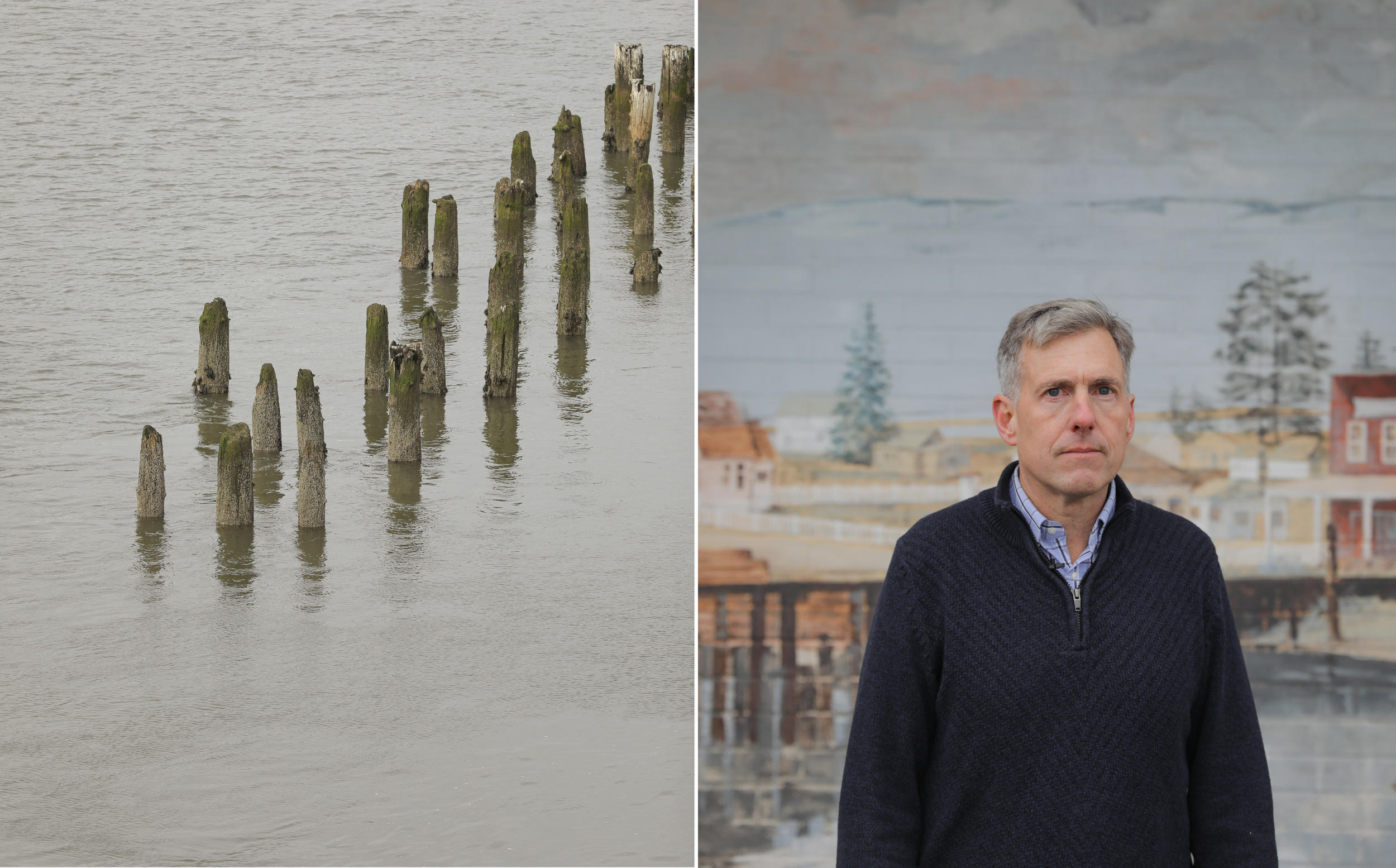
Left: Pilings mark the water level in the Hoquiam River. Right: Hoquiam City Administrator Brian Shay. (Genna Martin/Crosscut)
The idea of moving 25,000 people, though, is not only unappealing to twin-city residents, but impractical. Shay added that the twin cities don’t even have a lot of undeveloped, elevated land to build on.
Having done extensive risk assessment and planning for the coastal city of Taholah (pop. 657), the Quinault were selected for one of three federal Indigenous-focused $25 million resilience grants in November to help move community buildings.
More funding available to assist in making the existential leap of managed retreat, as the Quinault are doing, is giving people confidence to imagine that possibility for their towns and cities. “It’s easier to have those conversations,” FEMA’s Pritchett Jr. said.
Mitigation professionals advise against judging communities for continuing to invest in vulnerable places. Ultimately, the best decisions come from an affected community itself, which knows itself best. As communities like Aberdeen and Hoquiam attempt this, everyone else should watch. “We have a lot to learn,” Miller said.
“I believe it’s a perfect solution for us,” Shay said of the project.
Levees can be a good choice, because they’re a proven solution. Kevin Zerbe, the hazard mitigation specialist for the state, said they’re relatively easy to get funded, but they aren’t a permanent solution.
“Levees work for a while, sometimes decades,” he said, “but inevitably flood dynamics will change.”
The Hoquiam River leads to the Chehalis River near Hoquiam. The city is surrounded by water on three sides. (Genna Martin/Crosscut)
Listen to reporter Hannah Weinberger discuss this story on the Crosscut Reports podcast:
Related Stories


Get the latest investigative news
A newsletter for resources, data and behind-the-scenes insight into investigative efforts.