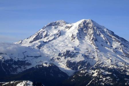
Glaciers are essentially slow-moving rivers of ice and snow that hold water like a storage tank. During summer months, their melt flows into streams and rivers. Emmons — the largest glacier in the continental U.S. — is an important freshwater source for the Puget Sound, feeding into the White River that runs along state Route 410. Although Emmons grew in size each winter for decades, its surface is now melting irregularly, which raises questions about flooding and water supply as the climate warms.
More research is needed to understand what the future could bring, as well as climate policy to significantly lower greenhouse gases and slow climate change. The Inflation Recovery Act, recently passed in the U.S. Senate, is aimed in this direction, including a goal to cut carbon emissions by about 40% by 2030 and invest in clean energy sources.
This July, like every summer for the last 14 years, Todd hiked to Emmons to sample water quality and measure debris ranging from boulders of solidified lava to fragments of talus, or alpine rock. Her fieldwork, currently funded by NASA and the University of Washington, allows for sampling that significantly adds to the information gathered through aerial mapping
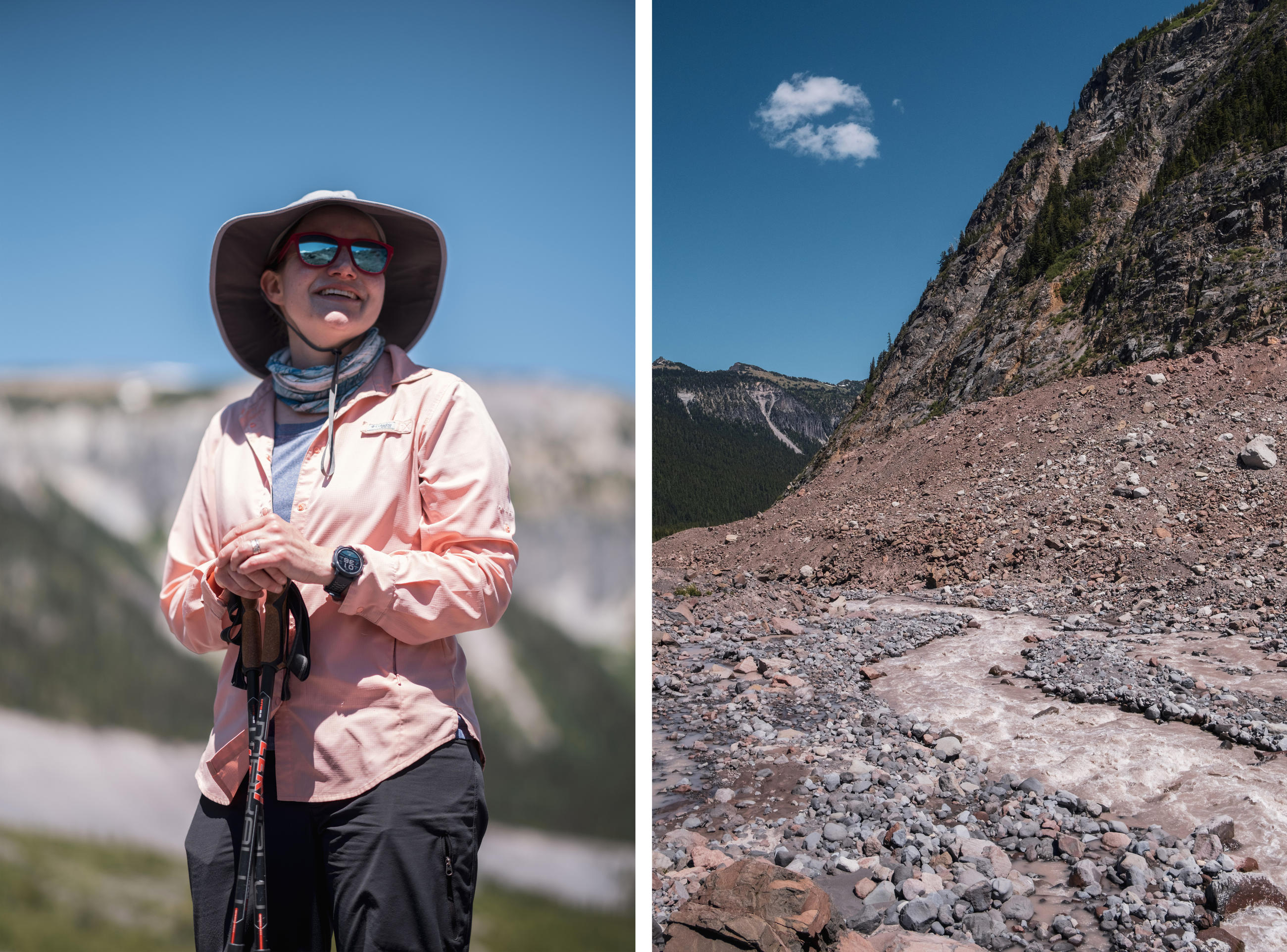
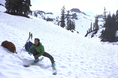
Left: CSUSB Professor Claire Todd admires the terminus of the Emmons glacier in Mount Rainier National Park. Right: The headwaters of the White River flow out of the terminus of the Emmons glacier in Mount Rainier National Park. (Nick Danielson for Crosscut)

University of Washington faculty member Dr. Michelle Koutnik, University of Washington Tacoma faculty member Dr. Peter Selkin, and CSUSB Professor Claire Todd descend to White River in Mount Rainier National Park, Washington. The group visited Emmons, the largest glacier in the continental U.S., in July to sample water quality and measure debris. (Nick Danielson for Crosscut)
When it melts, it pours
Todd shares her findings with the National Park Service, the only government entity closely monitoring the glacier and analyzing changes. National Park Service science technician Mike Larrabee and his team from the park service study Emmons’ snowpack and how much of it has melted compared to past years to better track how the glacier feeds the White River. For the last 20 years, nearly 16% of the glacier’s meltwater flowed into the river, which meanders along the northeast side of the mountain and serves as an unofficial border between King and Pierce counties. In low snowpack years, Larrabee’s team measured as little as 7% of the melt flowing into the river.
Like Todd, Larrabee travels on the glacier to take measurements. When setting out stakes for monitoring during the winter of 2014, Larrabee saw something unusual for the winter season: a deep channel in the snow.
“It was like someone had taken a snowplow and just cut through there,” he said. “It was missing snow. The drainage network of the glacier was just spilling out and funneled down into the canyon, almost like a little stream channel.”
At the lower end of the glacier, Larrabee found 64 million gallons of melted snow — enough water to fill 100 Olympic-size swimming pools.
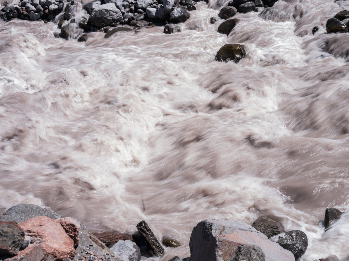
Glacial melt from the Emmons glacier creates the White River in Mount Rainier National Park. For the last 20 years, nearly 16% of the glacier’s meltwater flowed into the river, which meanders along the northeast side of the mountain and serves as an unofficial border between King and Pierce counties. In low snowpack years, Larrabee’s team measured as little as 7% of the melt flowing into the river. (Nick Danielson for Crosscut)
Scientists call this outburst flooding. This happens when glacier ice melts and abruptly releases water, which then flows downstream and temporarily overflows a river.
Those floods are a normal summertime occurrence, but warmer years are increasing the likelihood for bigger ones. In November 2017, park technicians discovered another outburst flood when it tore out and destroyed monitoring equipment at the White River Bridge near a campground.
The surge of water and sediment usually stays within the park during an outburst flood, but huge flows could have impacts farther downstream at the Mud Mountain Dam, which holds back floods before they can reach nearby towns like Enumclaw.
The dam is essential for flooding control, according to Joanna Curran, a civil hydraulics engineer within the Army Corps of Engineers. Mud Mountain was created in the 1940s to manage heavy rain and snowmelt, when glacial outbursts didn’t happen often.
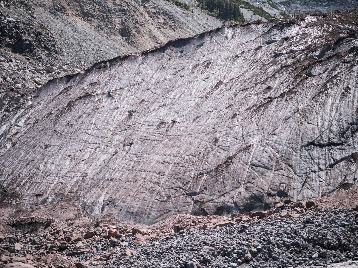
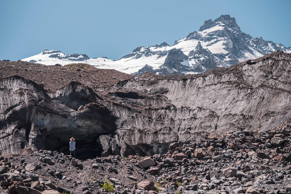
The terminus of the Emmons glacier, covered in debris. (Nick Danielson for Crosscut)
Emmons gets the least amount of sun compared to Mount Rainier’s other 24 major glaciers. However, its growth is largely attributed to insulation from a 1963 rockfall from Little Tahoma Peak — a craggy, snowy wedge that rises 2,000 feet above Emmons.
While layers of that rocky debris can protect the glacier from the sun, thin spots in its covering can also heat up the ice and accelerate melting. As a result, Emmons is retreating more quickly in the middle than its sides, leaving a horseshoe shape in its wake. As it steepens like a canyon, some areas are losing the rocks shading their ice from the sun. One lower section of the glacier shrunk by nearly 300 feet within just four years of shedding its rock cover.
More management adaptation may be needed to handle meltwater and the chunky sediment that comes with potential glacial outbursts, Curran said. As a possible solution, she is working with the United States Geological Survey to establish an early warning system that will notify dam managers and give them some time to adjust gates and valves to better control the fast-paced flood coming toward them.
“We want to make sure it doesn’t rip up the whole dam as it goes through so that we aren’t putting anyone at risk downstream,” Curran said.
Curran said her engineering team is modeling the potential hazards, because their existing data doesn’t give them a full picture of what would happen during an outburst flood.
Based on observations from the 1980 Mount Saint Helens eruption, Curran said the dam would likely reduce damage from an extreme flood and keep residents who live downstream safe. While an outburst flood in India in 2021 caused a dam failure and killed people, that level of danger is not a factor here, according to Curran.
Flooding is just one risk from melting glaciers like Emmons. When an outburst happens, the glacier loses water that can’t be quickly replenished by snow or rain, and suddenly flooding is no longer the top concern. Water shortages are then the focus after an outburst because the waterways fed by the glacier’s melt no longer receive the same dependable and sizable summer melt off.
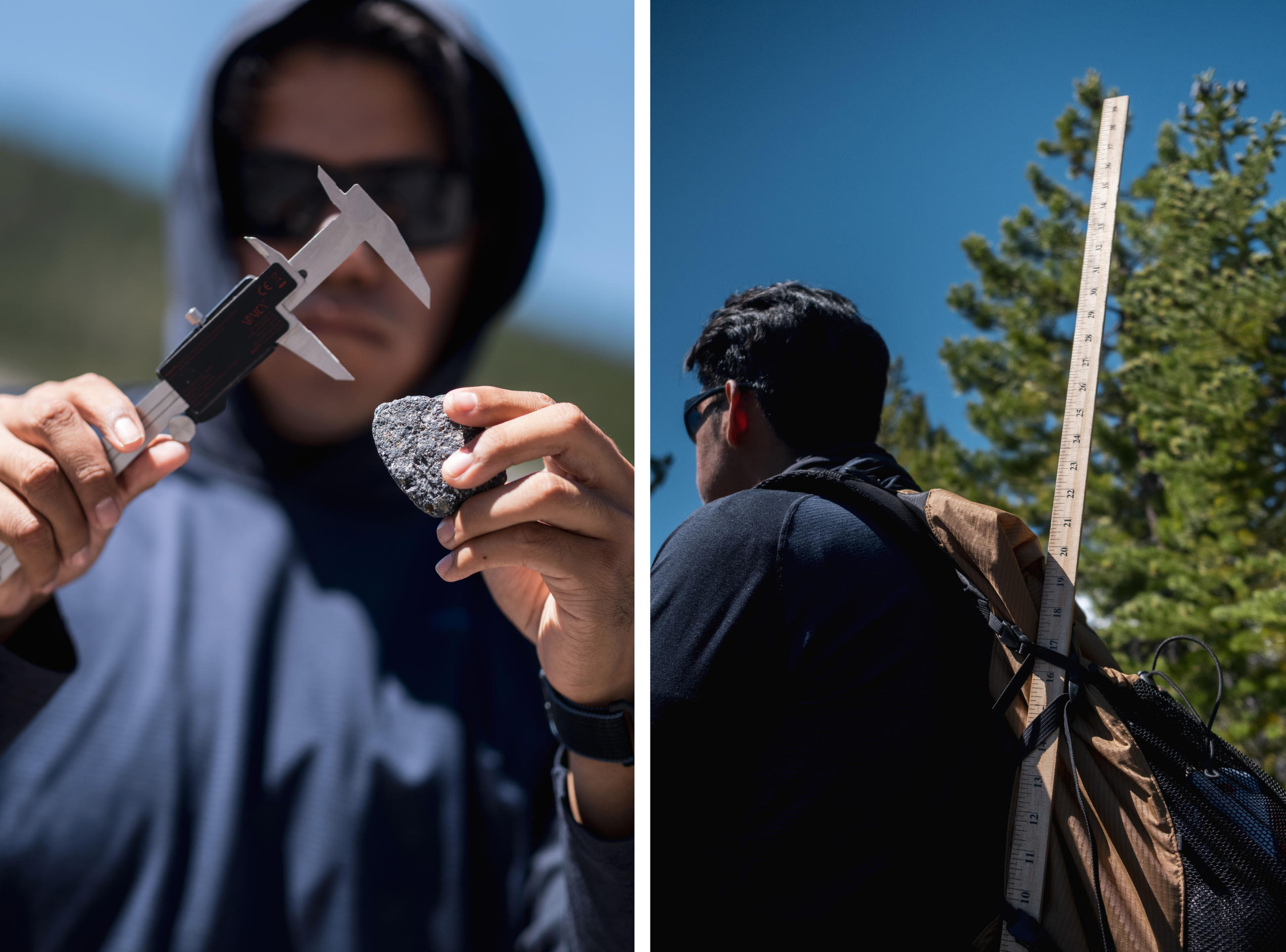
Left: CSUSB student Diego Centeno measures glacier debris under the terminus of the Emmons glacier. Right: Centeno carries a yard stick on his pack so the group can measure glacial debris. (Nick Danielson for Crosscut)
The remains of a glacier in retreat
In the field with Todd, geology student Diego Centeno sat in front of the ice cave, using a two-prong ruler to measure rounded rocks that looked smooth enough to be found in the ocean — a stark difference from the rough volcanic debris around him.
Centeno was looking to identify where the glacier retreated, a scientific description for when a glacier no longer extends down into a valley like it once did. This happens when a glacier is melting faster than it can accumulate snow and compress it into ice.
“We’re on the remains of a glacier,” Centeno said. “The rounder the rock, we know erosion came through and whether the glacier moved.”
When in retreat, a glacier loses its cache of freshwater, a significant natural resource for the Puyallup and White rivers, which form a basin that collects rainfall and snowmelt. This area is one of the Puget Sound’s biggest watersheds.
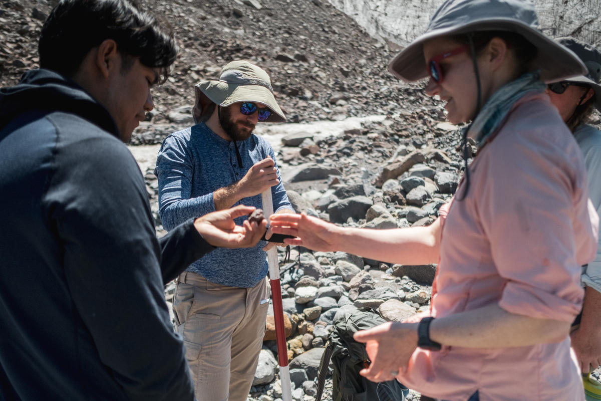
CSUSB Professor Claire Todd and CSUSB student Diego Centeno inspect debris from the Emmons glacier while CSUSB student Jacob Baker calibrates a GPS unit. (Nick Danielson for Crosscut)
When the snowpack is gone and precipitation is sparse in the summer, groundwater and glacial melt feed the streams, according to the Washington State Department of Ecology’s latest water availability report. With a high demand from a growing population, some areas in the watershed are experiencing a decline in groundwater levels and lower streamflows, creating the potential for water shortages in dry summers. The department has not “fully realized” the impacts of climate change in the watershed, according to the report, and the state does not have a long-term mitigation plan for glacier loss and drought implications.
That is in part because Western Washington’s watersheds replenish each year from the winter’s heavy rain, unlike the basins in the drier, eastern side of the state, said Jeff Marti, a drought coordinator with the ecology department.
Drier conditions west of the Cascade Range combined with increasing glacial runoff have scientists scrambling for alternative solutions to problems that no longer appear far off in the future.
“With climate change, the discussion tends to revolve around storage, because if the water is not going to stay high up in the watershed in the form of snow, then you need to find a way to detain it until it's needed,” Marti said.
Storage solutions could include new reservoirs. To avoid pouring concrete for new construction, water managers could turn to natural solutions like lakes. Meadows and wetlands could also stockpile water through their absorbent plants that can act like sponges.
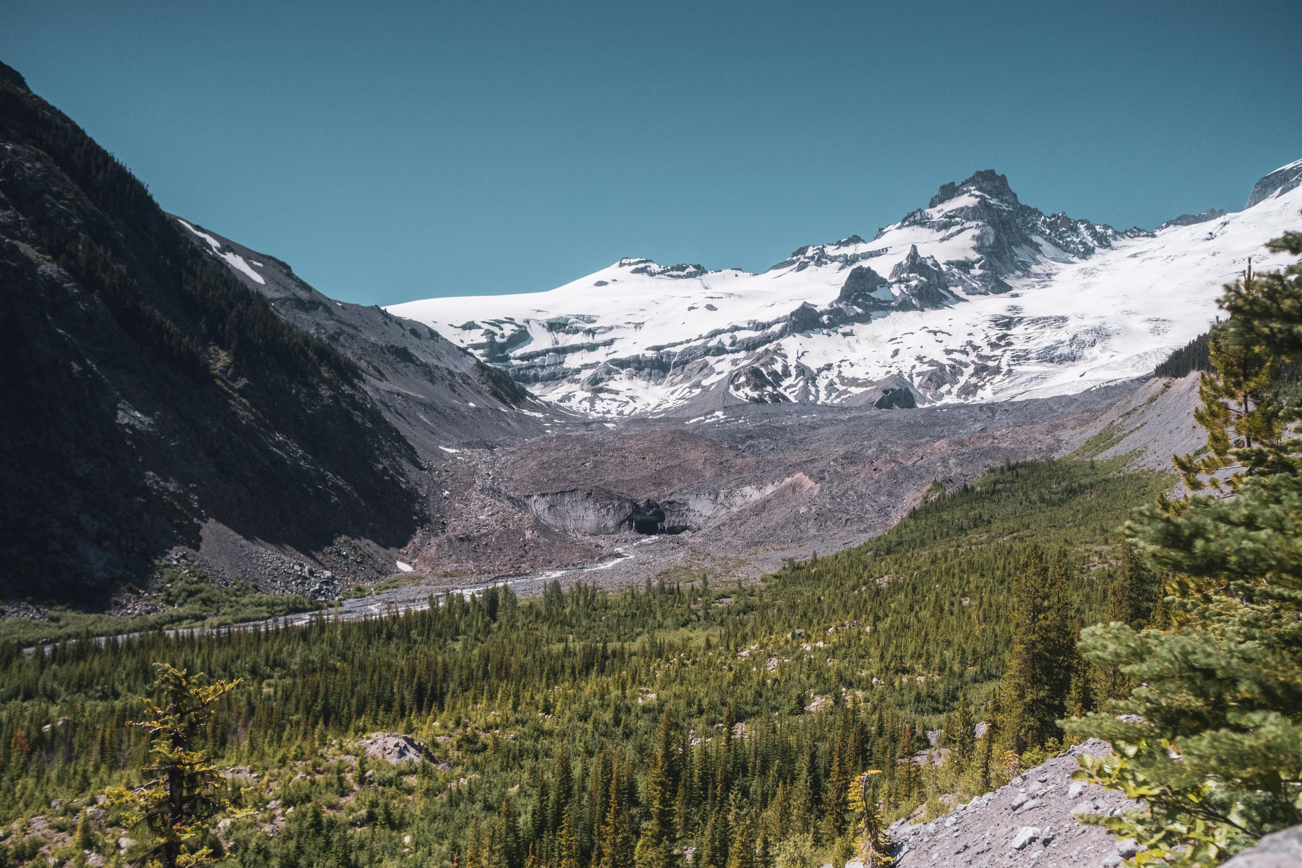
Little Tahoma Peak, a sub-peak of Mount Rainier, sits above the Emmons glacier and White River. (Nick Danielson for Crosscut)
What does it mean to save a glacier?
It will take combined scientific and political efforts to understand the evolution of the Emmons glacier and take meaningful action for its future. So far, many initiatives to protect glaciers are often superficial, said Mark Carey, director of University of Oregon’s environmental studies program and its Glacier Lab. In his book “Ice Humanities,” Carey unpacks various efforts to protect glaciers and explains why they fall flat. He points to European and Norwegian ski resorts that are blanketing areas of glaciers with tarps to try and deflect sunlight. It wouldn’t be feasible to protect Mount Rainier the same way, because simply, it’s too big, Carey said.
“In terms of saving the glaciers, I continue to think very strongly that we need better climate policies,” he said.
Laws to protect glaciers may not be what states like Washington need, according to a study by his lab and five other universities which analyzed the effectiveness of international glacier protection policies. The best way forward, according to Carey, is local and global leaders taking political action to cut carbon emissions and slow climate change.
It’s an effort that won’t be resolved in the lifetimes of researchers like Dr. Claire Todd, but Emmons has something working in its favor, unlike other glaciers that have already disappeared. The monolithic glacier is nearly 4.3 square miles, roughly the size of downtown Seattle. Its size is buying scientists and decision-makers a little time for climate adaptation planning.
However, Emmons’ magnitude is a double-edged sword. Although the glacier’s sweeping geography will likely prevent it from disappearing altogether anytime soon, it’s harder to study and understand. But that is not deterring Todd in her relentless pursuit to figure out the glacier’s uncertain future.
“For Rainier, you think about when these glaciers are going to be gone,” said Todd. “I mean they are retreating. Gone? That’s a long time away.”
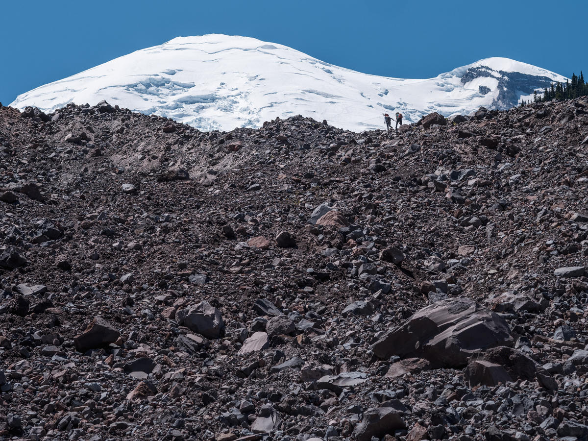
Dr. Michelle Koutnik and graduate student An Li hike above the terminus of the Emmons glacier under Mount Rainier. (Nick Danielson for Crosscut)